


Google Earth
3.8103.56K Reviews
App Specs
- Version
- Varies with Device
- Updated On
- License
- Free
- Downloads
- 500,000,000+
- Developer
- Google LLC
- Categories
- Travel & Local
- Platform
- Android, iOS
Screenshots
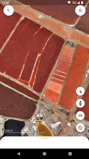
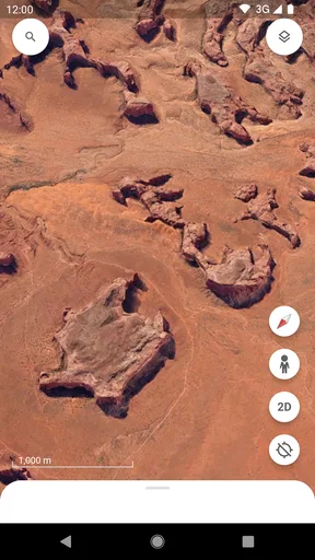
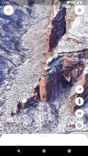
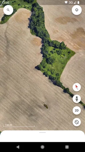
 Analysis by AppCompare
I use Google Earth less like a navigation tool and more like a window for understanding where places sit in relation to one another. That distinction matters: when I want step-by-step directions, I reach for a conventional map app. When I want to see the shape of a coastline, compare neighborhoods, or get a feel for a destination before I go, this globe is the more rewarding place to start.
Why the globe changes the way I explore
The central pleasure is moving from a view of the whole planet to a particular place without losing the sense of how it fits into the world. I can begin with a continent, follow a mountain range, and settle on a city, all by zooming and turning the globe. A flat map is often better for quickly judging routes and distances, but the curved view makes geography feel connected: islands, borders, terrain, and coastlines become easier to imagine as parts of a larger landscape.
That makes the app useful even when I have no trip in mind. I might hear the name of a town in a conversation, search for it, and then trace nearby rivers or roads to understand its setting. It is a small, satisfying habit, and one that can turn a quick lookup into a more thoughtful exploration.
Guides and Analysis on Google Earth
How I use it without getting lost in the view
Searching is the quickest way to reach a specific place, but I find the app most engaging when I use search as a starting point rather than the whole activity. After landing on a destination, I zoom out once or twice and look around. The wider view can reveal whether the place sits near a coast, a large urban area, or a landscape that changes sharply beyond the center.
For a practical trip-planning check, I would use this sequence: search the hotel or attraction, inspect its surroundings, then open nearby Street View coverage where available. That helps me notice context a basic pin can hide, such as whether a place appears close to a major road or whether the immediate area looks more residential than I expected. I still check a dedicated navigation app for current directions; Earth is better at visual orientation than at managing the details of a journey.
One helpful habit is to zoom in gradually instead of rushing straight to the closest view. The change in scale can make it easier to keep your bearings, especially when a city has dense blocks and a lot of visual detail. If I lose track of where I am, I search the place again and rebuild the view from a wider level rather than repeatedly pinching at random.
Seeing places before deciding where to go
Street View and 3D imagery give the app a useful second layer. A globe view answers, “Where is this?” A street-level view can help with the more personal question, “What might it feel like to arrive here?” Coverage and detail vary by location, so I treat the imagery as a preview rather than a guarantee of what I will encounter today.
Worth Reading Before You Choose

ESPN’s Live Game View Makes Following Close Games Easier

QuizzLand Review: A Good Fit for Short Trivia Breaks, Not Every Player

Basketball Stars: Multiplayer Is Fast, but Can It Recover When Matches Go Wrong?

WEBTOON Turns Phone Updates Into a Better Reading Routine

Link to Windows Runs on Shared Habits, Not Social Feeds

How Alibaba.com Dominates the B2B Marketplace
A realistic planning moment
Imagine I am meeting a friend in an unfamiliar part of a city. Before leaving, I search the meeting place, look at the surrounding blocks, and check Street View if imagery is available. I can get a better sense of the area and spot nearby landmarks that may help me recognize the location. Then I switch to a regular map for the actual route and timing. That division of labor is more reliable than expecting one app to do both jobs equally well.
The same approach works for choosing between possible vacation stops. I can compare the setting of two coastal towns, see which one appears more connected to nearby places, and explore the landscape around each. It will not tell me whether a café is open or whether a path is suitable for my needs, but it can help me ask better questions before I book or travel.
Curiosity is useful, but it needs a little direction
When I want a guided way to explore, Voyager offers interactive stories about places and subjects, including history and the natural world. I like that it gives a browsing session a thread to follow instead of leaving me to pick a random point on the globe. It is also a good option when I am sharing the screen with someone else: a story gives us something specific to look for and discuss.
The “I’m Feeling Lucky” button is a lighter alternative. I use it when I have a few spare minutes and want the app to choose a destination for me. It is a fun prompt, not a substitute for a carefully planned tour; the value is in seeing where an unexpected stop leads and then deciding whether to explore further.
A small but useful trade-off is that a striking 3D view can make a place feel more familiar than it really is. It helps me form a mental picture, but it does not replace local knowledge, current travel advice, or a live view of conditions. I try to treat the imagery as a way to orient myself, not as proof that a location will look exactly the same when I arrive.
Where it sits among travel and map apps
Compared with everyday map apps, this one is strongest when the goal is exploration rather than reaching an address efficiently. A standard map usually makes routes, nearby services, and turn-by-turn navigation easier to act on. Earth gives me a more immersive sense of terrain and place, and its globe-to-ground movement makes casual discovery feel natural. I would keep both kinds of tools in mind rather than asking Earth to replace a navigation app.
It also differs from browsing ordinary photos of a destination. Photos show a chosen angle; the globe lets me move around the area and connect one view to another. That freedom is valuable, but it can also make aimless browsing absorb time. I get more out of a session if I begin with a question, such as how a neighborhood meets the waterfront or what lies beyond a landmark, rather than simply zooming until the screen is full of detail.
Who will get the most from it
I would recommend it to curious travelers, geography enthusiasts, students, and anyone who likes to understand a place before visiting. It is especially satisfying for people who enjoy exploring landscapes and cities visually, rather than only checking an address or route. As a free travel and local app from Google LLC, it is easy to try without making a purchase decision, and its Everyone age rating makes it broadly suitable for casual family exploration.
Its reach is reflected in over 500 million installs, while an average rating of 3.8 across around 3 million ratings suggests that people’s experiences are not uniformly glowing. I can understand why: the app’s appeal depends on wanting visual exploration. Someone who only needs quick directions may find the globe movement slower than a conventional map, and anyone expecting every small location to have equally rich imagery may be disappointed by uneven coverage.
I also would not choose it as my only tool for an offline itinerary or a time-sensitive journey. The experience is built around examining places, not replacing every practical travel resource. If my priority is a reliable route, current local details, or a quick answer while walking, I switch to a purpose-built map. If my priority is seeing the broader setting and exploring from there, Earth earns its place on my phone.
A few details that shape the experience
The app has been available since February 22, 2010, and that long history helps explain why it feels familiar to many people, though the interface and available imagery can change over time. I would avoid assuming that every screen or location will look identical across devices. The more useful question is whether the globe, search, and visual browsing suit the way you want to explore.
For younger users, I would treat it as a shared discovery tool rather than assuming that every view automatically becomes a lesson. Asking a child to find a coastline, compare two landscapes, or follow a Voyager story gives the browsing a purpose. For independent study, it is a visual companion: it can make a place easier to picture, while books, class materials, and other sources provide the detail needed for deeper research.
If you are deciding whether to install it, ask yourself what you usually want from a map. If the answer is “tell me how to get there,” another app may be quicker. If it is “help me understand what this place looks like and where it sits,” this is a much better fit. That simple distinction prevents a lot of frustration and makes the app’s strengths easier to appreciate.
When you fire up Google Earth, you're greeted with a stunning view of our blue planet. It's like being an astronaut, minus the rocket and spacesuit. You can zoom in and out, spin the globe, and dive right into any location you fancy. Whether it's the vibrant streets of Tokyo or the serene beaches of the Maldives, every place is just a few taps away.
The app's interface is sleek and intuitive, making it super easy to navigate. You can use the handy search bar to jump to a specific spot or just let your curiosity guide you. I found myself exploring places I’d never even thought about, and it was a blast!
A World of Features
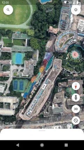
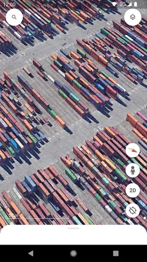
One of the coolest features is the Street View. You can literally walk the streets of major cities and check out the sights as if you were actually there. It's perfect for planning a trip or just indulging in some armchair travel. The 3D imagery is another highlight, bringing cities and landscapes to life in breathtaking detail.
For those who love a bit of trivia, the "Voyager" feature is a treasure trove of interactive stories about our world. From exploring the depths of the ocean to learning about ancient civilizations, it's an educational goldmine. I found myself lost in a world of stories, making every session both fun and informative.
Let's not forget the "I'm Feeling Lucky" button. Give it a whirl, and you might end up discovering a hidden gem you never knew existed. It’s like a digital spin-the-globe!
The Verdict: A Must-Have for Explorers
In a world where travel isn't always possible, Google Earth offers an amazing alternative to satisfy your wanderlust. Whether you're a geography buff, a travel enthusiast, or just someone looking for a bit of escapism, this app is a must-have.
So, if you haven't already, grab your phone, download Google Earth, and start exploring. Who knows what adventures await just a swipe away? It's like having the world at your fingertips, and I can't recommend it enough!
Pros
- High-resolution satellite imagery.
- User-friendly interface.
- 3D terrain and buildings.
- Street View integration.
- Offline maps available.
Cons
- Large app size.
- Requires strong internet connection.
- Limited real-time updates.
- Battery-intensive during use.
- Complex features may overwhelm beginners.
FAQs for Google Earth
What is Google Earth and how does it work?
Google Earth is a virtual globe application that allows users to explore the world through detailed satellite imagery, maps, terrain, and 3D buildings. By using a combination of satellite photos, aerial images, and geographic data, Google Earth enables users to navigate to any location on the planet, view topography, and explore various geographical features.
What platforms support Google Earth, and is it free to use?
Google Earth is available on multiple platforms, including Android, iOS, and desktop computers via web browsers. The application is free to download and use, offering a wide range of features without additional costs. There are no hidden fees, although certain professional features might require a Google Earth Pro subscription.
What features are unique to Google Earth?
Google Earth offers several unique features such as "Voyager," which provides interactive guided tours; "Time-lapse," allowing users to see changes over time; and "Street View," offering a ground-level perspective. Additionally, the 3D buildings and terrain provide an immersive experience, enhancing the exploration capabilities of the app.
How accurate is the imagery in Google Earth, and how often is it updated?
The accuracy of Google Earth's imagery varies depending on the location and the data source. Urban areas tend to have more detailed and up-to-date images, while remote regions may have older data. Google regularly updates its imagery, but the frequency can vary. Users can explore historical imagery to see changes over time.
Can Google Earth be used for educational purposes?
Yes, Google Earth is an excellent tool for education, offering features that can enhance learning in geography, history, and environmental science. Teachers and students can utilize the app for virtual field trips, exploring different cultures and landscapes, and understanding global issues through interactive content and real-world data.


